Event Description
Mountain Watershed Association and the Youghiogheny Riverkeeper would like to announce the 2nd Annual Ohiopyle Falls & Trails Trilogy in Ohiopyle State Park. The festivities and races will take place Saturday, Oct. 10, and Sunday, Oct. 11, 2019. This series of races will highlight the variety of recreational activities the river valley provides by giving river and trail lovers alike a weekend of paddling over the Ohiopyle Falls, trail running and mountain biking. Take part in all or just one race, come to watch, or do a little bit of both. Registration for any event includes a Ohiopyle Falls & Trails Trilogy T-Shirt! All proceeds from MTB Poker Run benefit the Ohiopyle Biking Club. $5 from every event participant will be donated to the Ohiopyle-Stewart Volunteer Fire Department.
Event details and schedule
OHIOPYLE FALLS & TRAIL TRILOGY SCHEDULE:
Saturday, October 10, 2019
8am - Mountain Biking "Poker Run" Begins
9am-3pm - Ohiopyle Falls Open to Paddling
Noon - Ohiopyle Falls Race Begins
Evening - Concert (Band TBA) near Wilderness Voyageurs
Sunday, October 11, 2019
8am - 10K, Half Marathon, Full Marathon Begins
MOUNTAIN BIKING:
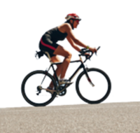
The Ohiopyle Biking Club Poker Run is a mountain bike event that will showcase the best single track Ohiopyle has to offer. Starting at the main trailhead riders will have three hours to make the 1500+ ft descent down into Ohiopyle. Which trails they take is totally up to them but they will need to stop at 5 checkpoints along the way.
Each checkpoint will be located at various points of interest on the trail system. Each rider will have a map given to them that shows where each checkpoint is and some suggested routes to take in order to hit each of the 5 checkpoints.
When riders get to a checkpoint they will draw a card from a deck, and a volunteer will mark their scorecard with the card suit and rank. When all the riders make it down the mountain to our final checkpoint they will have 5 cards marked on their scorecard, this will form their poker hand. The person with the best 5 card hand at the end of the day wins a portion of the entry fees.
Riders can ride solo or with a group of friends and everyone can ride at their own pace. Mileage will depend on your chosen route but should end up being between 8 and 15 miles. No poker skills needed. Our volunteers will check the cards and declare a winner.
PADDLING:
Ohiopyle Falls will be open to paddling between 9am and 3pm on Saturday. Race starts at noon!
TRAIL RUNNING:
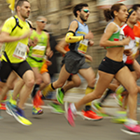
All three trail races are on single track, technical, hilly, rocky, terrain for 95 percent of the courses.
Packet pick-up: 4-6 p.m., Saturday, Oct. 10 & 6-7:30 a.m., Sunday, Oct. 11 at Ohiopyle Falls Overlook area (start/finish area). MANDATORY pre-race meeting at 7:45 a.m. on race-day for all runners in all distances.
Top three females and males in each race will be awarded. Winner will receive award as they cross the finish line. No awards ceremony. All finishers receive finisher medal. All runners receive an Ohiopyle Falls & Trails Trilogy t-shirt.
COURSE DESCRIPTIONS:
Full Marathon Trail Race Description:
Begin at the Falls Overlook area in Ohiopyle State Park. Run from the Falls Overlook upstream. At 0.1 miles, bear right at Falls Market, and then make the very first left to get on the Great Allegheny Passage (GAP), a doubletrack, flat rail trail. Make a right to run on the GAP for about a quarter mile until you see the Baughman Trail and Sugarloaf Trail trailhead signs. Follow Sugarloaf Trail and climb for about 3.7 miles until you come out on a dirt road. Make a left on the dirt road for a quarter mile until you get to a three-way intersection with a paved road and another dirt road, Presley Ridge Road. Take Presley Ridge Road for less than a quarter mile and bear left onto Sarver Road. You'll climb Sarver Road for 2.5 miles. Near the end of the dirt road when you see the paved Sugarloaf road, take a left onto Sugarloaf Trail, the singletrack again, and follow it for one mile, descending the Sugarloaf Sledding Hill to pass two big parking lots on your right (aid stations will be here). Descend a narrow trail amongst tall grasses for one mile until you see the Baughman Trail sign. Make a right to follow Baughman Trail, crossing the paved Sugarloaf road to access the singletrack of baughman. You'll run amongst large boulders, over some small bridges and streams and pass by Baughman Overlook on your right. Once you reach Baughman Overlook, you'll be at about mile nine of the marathon course. Descend for 2.5 more miles into Ohiopyle, where you'll come out on the GAP around mile 11.5.
Once you're on the GAP, run across two high bridges over the Yough River. At about mile 12 (you'll see course marshals here), turn left where it says "Campground" and quickly turn right to enter Beech Trail. You'll see an official state park sign for Beech, which runs parallel to the GAP. At about mile 14, when you come to a T in the trail at a stream, turn right and scramble down a bank back to the GAP. Run 1.7 miles on the GAP. At about mile 15.7ish, you'll see the signs for Jonathan Run. Turn left to follow Jonathan Run trail, along the creek, for a 2.6 total there and back. Runners must run all the way to the Jonathan Run parking area, where you'll have a MANDATORY check-in (mile 17 for marathoners), and then turn around. Runners who do not check in here will receive a DNF. Make a tight righthand turn to follow Kentuck Trail, straight uphill for 3/4 miles until you get to the campground, where you'll come out onto a paved campground road near a parking lot. Bear right as soon as you exit the singletrack onto the paved road briefly to pass a parking lot on your right, running through the four-way intersection to the edge of the woods on the other side and connect to Kentuck Trail.
Run to Tharpe Knob overlook! When you get to Tharpe Knob, you'll exit the woods into grass where you'll see a playground and pavilions, which is Tharpe Knob Picnic Area. Stay in the grass, along the tree line, turning right to run along the trees to the wide uphill path leading to the overlook. At the overlook you'll hit the 20ish mile mark. Run down the fitness trail for about half a mile to connect back to Kentuck Trail. Turn left on Kentuck Trail. Run 1.8 miles until you see the sign for Great Gorge. Make a right at the Great Gorge sign and run mostly downhill for 1.5 miles until you get to the GAP again. Continue across the high bridges, cross the main road and make your way back to the start/finish area.
Total Miles: 26.3
Elevation gain: 3,521 feet/ Elevation loss: 3,548 feet
3 Fully Stocked Aid Stations and at least 3 Mandatory Checkpoints (i.e., all runners must be seen here in order to receive finisher's medal). They will be around Mile 7, 16 and 20.
Cut-off: 7.5 hours
Half Marathon Trail Race Course Description:
Start line begins at the Ohiopyle Falls Overlook. You'll begin running upstream along the sidewalk of the Yough. At 0.1 miles, bear right at Falls Market to cross Rt. 381, and then make the very first left to get on the Great Allegheny Passage (GAP), a double track, flat rail trail. Run across two high bridges over the Yough River. At 0.9 miles, turn left where it says "Campground" and quickly turn right to enter Beech Trail. You'll enter Beech Trail at about one mile into the run. You'll see official state park sign for Beech, which runs parallel to the GAP. At about two miles when you come to a T in the trail at a stream, turn right scram down a bank back to the GAP. Run 1.7 miles on the GAP. At mile 3, you'll see the signs for Jonathan Run. Turn right to follow Jonathan Run trail, along the creek, for a 2.6 total there and back. You'll cross a wide wooden bridge immediately. At 4.45 mi, you'll cross the narrow wooden bridge. Run all the way to the Jonathan Run parking area, where you'll turn around - be sure to actually loop around the rock at the trailhead! You'll cross the narrow bridge again around 6.2 miles. You'll cross the wider wooden bridge around 6.5 miles. Turn right to follow Kentuck Trail, straight uphill for 3/4 miles until you get to the campground, where you'll come out onto a paved campground road near a parking lot. Turn right onto the road, pass the parking lot on your right, run through the four-way intersection to the edge of the woods on the other side and connect to Kentuck Trail.
Run to Tharpe Knob overlook! When you get to Tharpe Knob, you'll exit the woods into grass where you'll see a playground and pavilions, which is Tharpe Knob Picnic Area. Stay in the grass, along the tree line, turning right to run along the trees to the wide uphill path leading to the overlook. At the overlook you'll hit 9.3 miles. Run down the fitness trail for about half a mile to connect back to Kentuck Trail. Turn left on Kentuck Trail. Run 1.8 miles until you see the sign for Great Gorge. Make a right at the Great Gorge sign and run mostly downhill for 1.5 miles until you get to the GAP again. Continue across the high bridges, cross the main road and make your way back to the start/finish area. You'll run the three viewing decks at the falls and loop once around the parking lot for your complete half marathon! My Garmin clocked the run at 13.0 miles exactly, while Trail Run Project clocked it at 13.8 mi.
Elevation Gain: 1,658 feet
2 Fully Stocked Aid Stations and 2 Mandatory Checkpoints (i.e., all runners must be seen here in order to receive finisher's medal). They will be located around Mile 6 and Mile 9.3.
Cut-off: 5 hours
10K Trail Race Course Description:
Run from the Falls Overlook upstream. At 0.1 miles, bear right at Falls Market, and then make the very first left to get on the Great Allegheny Passage (GAP), a double track, flat rail trail. Run across two high bridges over the Yough River. At 0.8 miles, turn left on Great Gorge spur trail (it is unmarked and NOT the main Great Gorge trail; it is the first trail on the left after passing the main Great Gorge Trail sign.) Run uphill on single track for three quarters of a mile (stay left as you pass the intersection for the campground midway). At 1.6 miles, turn left onto Kentuck Trail and run to Tharpe Knob. You’ll exit the woods at about 3.0 miles into grass where you’ll see a playground and pavilions. Turn right immediately and run along the tree line to the wide uphill path leading to the overlook. From the overlook, run down the fitness trail to connect back to Kentuck Trail. Turn left on Kentuck Trail at 3.5 miles. Run along Kentuck Trail and make a right back down Great Gorge spur (the same way you ran up) at 5 miles. At the bottom of the hill, turn right onto the GAP rail trail and run across the two bridges. Turn right at the Visitors Center, turn right onto the street/sidewalk and cross the main road at Falls Market. Make your way back to the finish, running downstream along the river until the finish line at the beautiful 18-foot Ohiopyle Falls! The course is a lollipop and about 6.7 miles, a bit more than the official 10K (6.2 mi) distance, in classic trail race style.
Total elevation gain: 1,000 feet
1 Fully Stocked Aid Station and at 1 Mandatory Checkpoint (i.e., all runners must be seen here in order to receive finisher's medal). It will be at the middway point, Tharpe Knob.
Cut-off: 3 hours
Rules & Regulations:
No removing or tampering with signs, flagging or directional signs - any runner caught doing so will receive a DNF.
No transfers (i.e., if you sign up for the marathon, you cannot transfer to the half, if you sign up for the half, you cannot transfer to the 10K)
No pacers.
No drop bags.
No cutting course or going off-trail - any runner caught doing so will receive a DNF.
Runners must stop to help injured runners.
No littering.
No dogs or pets.
No strollers.
Smile and have fun!
MORE INFORMATION & UPDATES:


